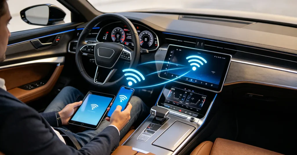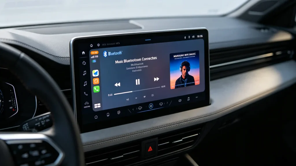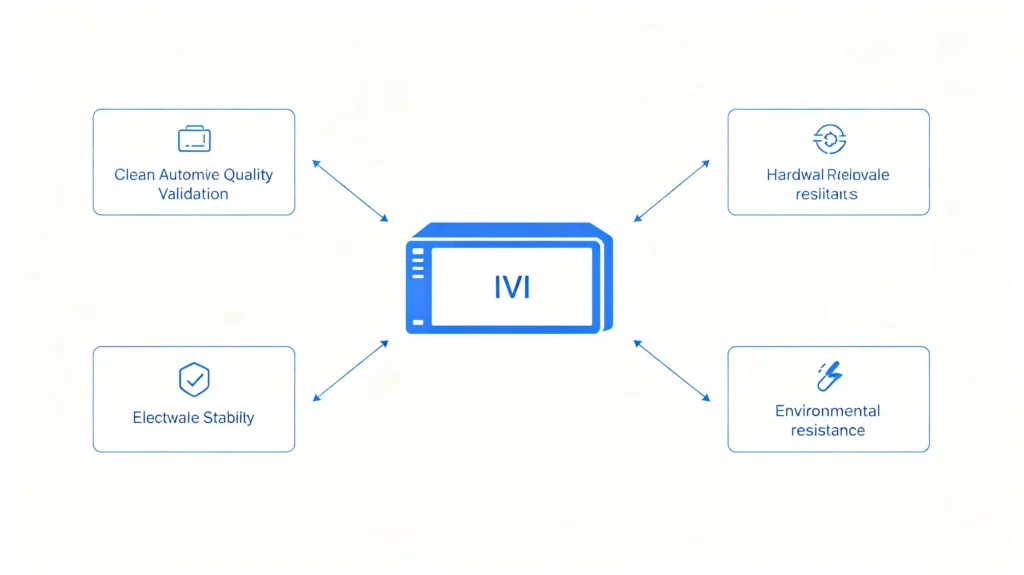


Navigation is now a baseline expectation in vehicles sold across nearly every market, not a premium extra. But for wholesalers, dealers, and automakers evaluating suppliers, knowing what “navigation” actually involves under the hood matters more than the marketing copy on a spec sheet.
This guide walks through the components that make navigation possible, the full step-by-step process from satellite signal to on-screen route, the core technologies behind modern systems, and the technical factors that separate a reliable unit from one that fails in the field. For a foundational overview of what these systems are and how they’re built, see our guide: What Is a Car Navigation System?
Core Components Required for Car Navigation Operation
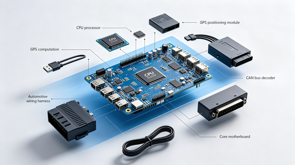
Before the workflow makes sense, it helps to know what’s actually inside the unit.
Hardware Parts of Car Navigation Units
On the hardware side: a main processing board (CPU/SoC), a display screen, a GPS/GNSS module for satellite reception, a CANBUS decoder for vehicle data, a wiring harness, and an antenna.
Supporting Auxiliary Accessories
Supporting accessories — reverse cameras, DVR dash cams, external GPS antennas — often connect into the same unit. These accessories extend the device’s role beyond basic routing functions alone.
Why Component Quality Impacts End User Experience
Component quality here isn’t cosmetic. A weak GPS module or an under-engineered CANBUS decoder shows up later as poor positioning accuracy or vehicle features that don’t sync correctly. That is why incoming component inspection (IQC) matters as much as final assembly. For a detailed breakdown of each hardware component and what to look for, read Components of a Car Navigation System Explained.
Step-by-Step: How Does a Car Navigation System Work?
The full operating sequence follows a consistent pattern across brands and platforms. Below is every stage broken down simply:
- Satellite signal acquisition — the antenna picks up signals from GNSS satellites overhead.
- Position calculation and validation — the module triangulates the vehicle’s location using signals from multiple satellites at once.
- Map loading and position display — the head unit pulls relevant map tiles from storage and plots the vehicle’s current position.
- Destination input and route calculation — the system evaluates possible paths based on distance, and, where connectivity allows, live traffic and toll data.
- Real-time turn-by-turn guidance — visual cues and voice prompts guide the driver toward each maneuver.
- CANBUS communication — vehicle data (steering wheel controls, reverse gear signal, door sensors) syncs with the display in parallel.
- Arrival and journey history — the system confirms arrival and typically logs the route for future reference.
Why Stable Navigation Workflow Matters for B2B Buyers
For fleet management operators, rental companies, and 4S dealerships, this sequence runs continuously and reliably across thousands of trips a day.
This is exactly why component quality and software stability matter more in a commercial context than in a single consumer vehicle.
Explore our Android Car Navigation Systems product lineup to see these features in production hardware.
Core Navigation Technologies Behind Modern Vehicle Systems
Modern navigation doesn’t rely on one single technology. We break down every key tech stack below:
Multi-Constellation GNSS Positioning
Global Navigation Satellite Systems (GNSS) include GPS, GLONASS, BeiDou, and Galileo. They provide the base positioning layer for all car navigation units. Multi-constellation support improves accuracy and reduces coverage gaps in complex road environments.
Dead Reckoning Signal Compensation
Dead reckoning (DR) fills location data gaps when satellite signal drops. It uses speed sensors and gyroscopes to estimate vehicle position. This function works well when cars pass through tunnels or dense urban canyons until satellite signal returns.
Cellular OTA Update & Traffic Function
Cellular connectivity (4G/5G, where available) brings two core values. First, it loads real-time traffic data for dynamic route planning. Second, it supports over-the-air (OTA) updates for firmware, offline maps and system UI interfaces.
CANBUS Vehicle Electronic Integration
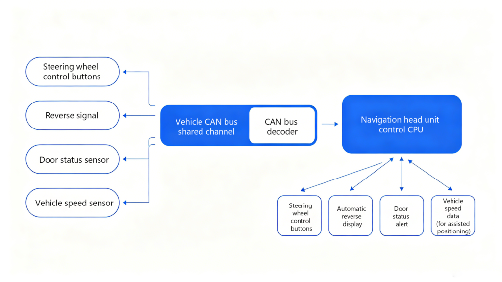
CANBUS integration ties navigation hardware into the vehicle’s broader electronic network. It lets the head unit read and control native car functions smoothly.
Multi-Language Global Export Support
Multi-language system support — commonly 30 or more languages — lets a single hardware platform serve widely different export markets. For a complete breakdown of the main system types available on the wholesale market, see our guide on types of car navigation systems.
Choosing the right supplier is just as important as the technology itself. Read our guide on how to choose a car navigation system supplier.
How GPS Navigation System Signals Power In-Car Positioning
Basic Working Logic of GPS Satellites
GPS satellites orbit at roughly 20,200 km altitude. They broadcast almanac and ephemeris data nonstop. This data tells a receiver where each satellite sits and when it sent its radio signal.
A GPS navigation system calculates position by measuring time delay from at least four satellites simultaneously. This mathematical process is known as triangulation. It can lock down precise latitude, longitude, and altitude of the vehicle.
Common Factors That Hurt Satellite Reception
Reception quality depends on real-world driving conditions. Tall buildings, tunnels, dense tree cover, and atmospheric interference can all degrade signal strength. These barriers may also create multipath errors. A multipath error happens when satellite signals bounce off a surface before reaching the car’s antenna.
Sensor Fusion for Automotive-Grade Positioning
To compensate weak GPS signals, many modern systems add extra positioning layers. These layers include Wi-Fi positioning and cellular tower triangulation. The onboard hardware runs sensor fusion to combine all location data sources.
For automotive applications specifically, this places strict real demands on the GPS module itself. Automotive-grade components need high enough sensitivity to maintain satellite lock in challenging environments. Multi-constellation support also keeps positioning accuracy consistent across global regions.
See our Android Car Navigation Systems product pages for specifications on multi-constellation support and module sensitivity.
How On-Board Head Units Process & Render Navigation Data
Step 1: Raw Satellite Signal Correction
Once signals are received, the head unit takes over all data processing work. It first filters and error-corrects raw satellite signals. The unit blends cleaned signals with onboard sensor data, including speed sensors and accelerometers. This step smooths out positioning jitter during brief signal gaps.
Step 2: Map Loading & Intelligent Route Calculation
From there, the unit loads map data from local internal storage. It can also pull fresh map updates via OTA cellular or Wi-Fi networks. Next, it runs a route calculation algorithm. The algorithm weighs trip distance, road speed limits and real-time traffic conditions. It finally renders the result on-screen as a 2D or 3D map. The screen highlights planned routes and overlays live traffic status.
Step 3: Real-Time User Input Interaction
All user input feeds back into the same processing loop instantly. Supported input methods include touchscreen taps, physical steering wheel controls and voice commands.
How Processing Hardware Differentiates Product Grades
Processing capacity here is a genuine differentiator between budget and premium units: CPU, RAM, and storage all affect how quickly maps render and how responsive the interface feels.
Manufacturers offering RAM/ROM configuration options or UI and boot-animation customization give buyers more room to match hardware to their target market. Explore our Android Car Navigation Systems product lineup to see available hardware configurations.
Key Technical Factors That Affect Navigation System Performance
A handful of factors consistently separate accurate, reliable navigation systems from unreliable low-end products. We list every critical metric below:
- GPS module sensitivity — weak modules lose satellite lock more easily in urban or covered driving environments.
- Processing power — underpowered CPUs and limited RAM slow map rendering and automatic route recalculation.
- Antenna quality and placement — poor antenna design undermines performance even when paired with a high-quality GPS module.
- Firmware optimization — poorly tuned software wastes the potential of good physical hardware.
- CANBUS decoder compatibility — mismatched decoders cause vehicle data sync failures between car and head unit.
- Power stability and noise filtering — electrical noise in a vehicle’s wiring can disrupt signal processing without proper filtering design.
- Map data freshness — outdated offline maps undercut route accuracy regardless of high-end hardware quality.
Factory Testing Standards to Verify Performance
Environmental durability testing verifies all above factors before finished units ship to buyers.
Standard lab tests include 48-hour continuous aging tests, high-temperature testing around 60°C, and vibration testing. Vibration testing simulates bumpy real road conditions. These strict tests catch hardware failures that would never appear on a static bench test.
Complete QC Chain for Stable Bulk Orders
A full inspection chain guarantees consistent product quality for wholesale clients. The chain covers incoming material QC (IQC), in-process inspection (IPQC), finished-unit function testing (FQC), and pre-shipment sampling (OQC). This full standard separates reliable long-term suppliers from risky one-order vendors.
For a deeper look at OEM versus aftermarket approaches — and how to evaluate suppliers — read our guides on OEM vs Aftermarket Car Navigation Systems and How to Choose a Car Navigation System Supplier.
OEM vs. Aftermarket: A Quick Comparison for Buyers
One question that comes up repeatedly in B2B sourcing is whether to go with OEM or aftermarket navigation systems. The table below lays out the key differences.
| Aspect | OEM Systems | Aftermarket Systems |
|---|---|---|
| Integration | Factory-installed, built for one vehicle platform | Retrofitted, fits multiple vehicle models |
| CANBUS support | Native, fully integrated | Decoder-dependent, varies by supplier |
| Customization | Limited by automaker specifications | Flexible (UI, logo, hardware config) |
| Updates | Typically dealer-managed | Often OTA or user-managed |
| Typical buyers | Automakers, Tier-1 suppliers, 4S dealers | Wholesalers, distributors, fleets |
Both approaches can deliver solid navigation performance. The right choice depends entirely on your business model and target sales market. Aftermarket buyers, in particular, should verify CANBUS compatibility for each specific vehicle model. Do not assume one decoder works universally for all cars. For a deeper look at OEM versus aftermarket approaches, read our guide on OEM vs Aftermarket Car Navigation.
FAQ
Do all car navigation systems only use GPS signals for positioning?
No. Most modern systems combine GPS with other GNSS constellations — GLONASS, BeiDou, or Galileo — for better coverage, and supplement satellite data with dead reckoning (speed sensors and gyroscopes) to maintain positioning through tunnels or dense urban areas. Relying on GPS alone leaves gaps in accuracy that multi-constellation and sensor-fusion approaches are designed to close.
What common factors cause GPS signal loss in wholesale navigation products?
Physical obstructions — tunnels, parking structures, dense tree cover, and tall buildings — are the most common cause, along with poor antenna placement or a low-sensitivity GPS module. In wholesale sourcing, this is worth testing directly rather than trusting spec sheets alone, since module quality varies significantly between suppliers even at similar price points.
Can standard car navigation systems work in tunnels or underground parking lots?
Briefly, yes, through dead reckoning — using speed and directional sensor data to estimate position while GPS signal is unavailable. Accuracy degrades the longer the vehicle stays without a satellite fix, so systems re-anchor to GPS as soon as signal returns. Longer tunnels or extended underground parking will show more positional drift than short gaps.
What technical specs should importers verify to confirm navigation accuracy?
Ask suppliers directly about GPS module sensitivity and multi-constellation support, CANBUS decoder compatibility with your target vehicle models, and whether units have passed aging, high-temperature, and vibration testing. Request test reports rather than relying on marketing claims, and where possible, order samples to verify real-world signal lock time and accuracy before committing to a bulk order.
How does navigation technology differ between OEM and aftermarket head units?
OEM systems are engineered and tuned for one specific vehicle platform from the start, with CANBUS integration built in natively. Aftermarket units need to be adapted to a broader range of vehicles, which places more weight on decoder flexibility and firmware quality to achieve comparable integration. Both can perform well, but aftermarket buyers should verify CANBUS compatibility per vehicle model rather than assuming universal fit.
Conclusion
Understanding how a car navigation system actually works — from satellite signal to on-screen guidance — gives B2B buyers a real basis for evaluating suppliers. You will no longer only compare superficial spec sheets without technical judgment.
Module quality, processing power, CANBUS compatibility, and documented QC testing are the four core standards. They decide whether a navigation unit performs reliably in large-scale wholesale distribution.
Evaluating navigation system suppliers for your next order?
Contact our team to discuss technical specifications, request test documentation, or explore our current Android Car Navigation Systems product lineup to see available configurations.
Not sure which navigation type fits your market? Download our free B2B Navigation System Buyer’s Guide for a complete specification checklist.